
Watsonville could look considerably different by 2050, with thousands of new homes, expanded shopping and entertainment opportunities, redesigned streets and new neighborhoods on the city’s outskirts.
Those possibilities are outlined in the city’s Draft General Plan 2050, unveiled Wednesday as Watsonville officials invited residents to weigh in on a document that will guide development and public investment for the next quarter-century.
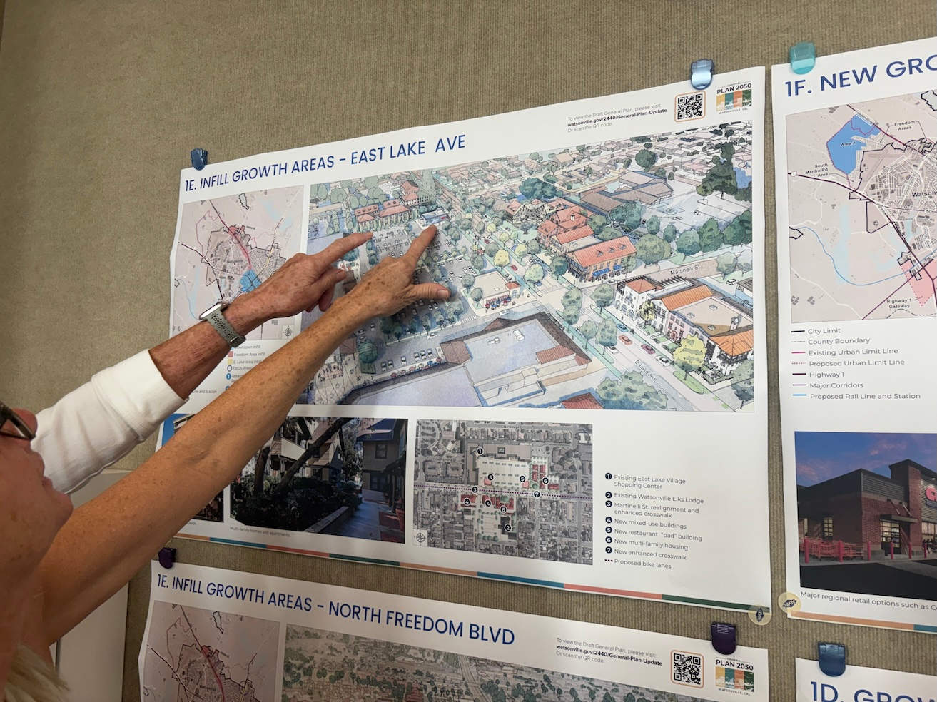
More than 100 people packed the community room on the top floor of the Civic Plaza to hear from city officials about how they are planning to shape the city.
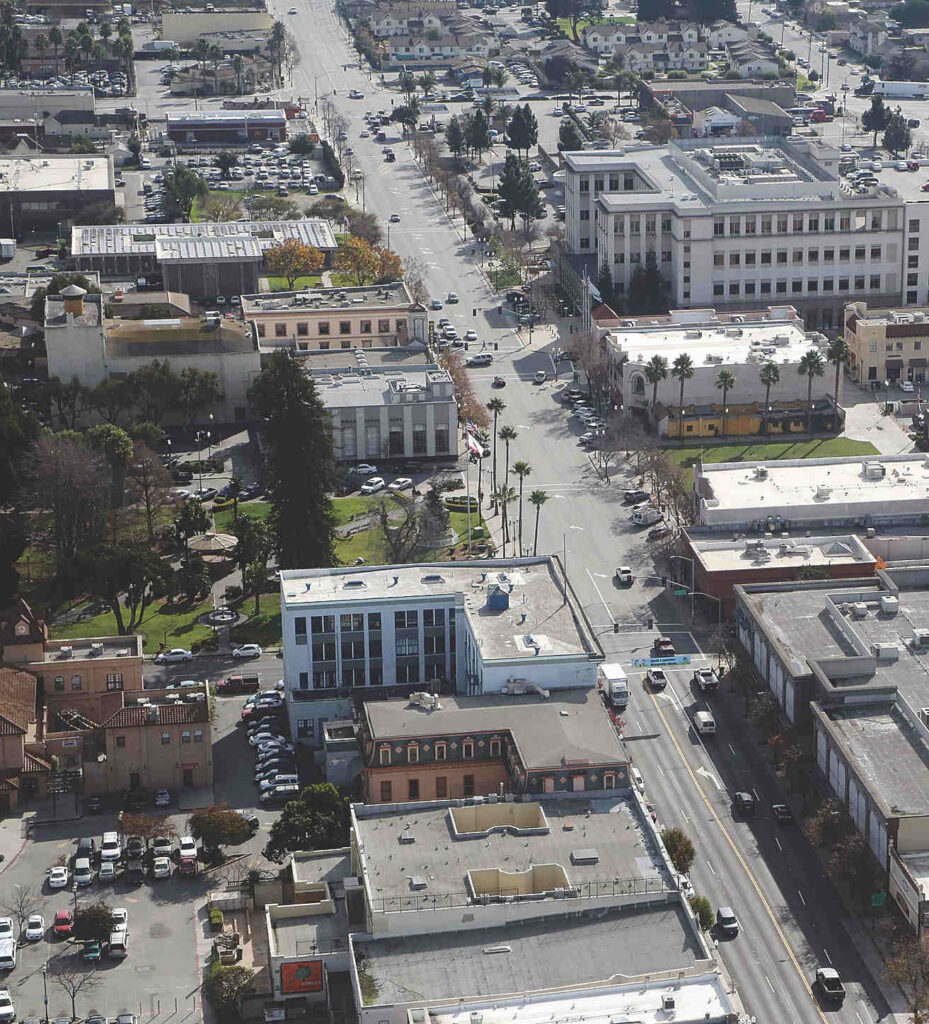
The plan envisions approximately 5,980 additional housing units and 2.67 million square feet of nonresidential development, with much of the residential growth concentrated downtown and along existing commercial corridors.
But the proposal is about more than new buildings. It addresses everything from parks and libraries to airport operations, flood protection, public safety and transportation.
City Manager Tamara Vides described the General Plan as a guide for the decisions Watsonville will make over the next quarter-century.
The general plan … is really our roadmap for the future,” she said. “It just really guides us and inspires to just kind of come together as a community, share our vision, and then work for that Watsonville that we all want to build together.”
City officials emphasize that the plan establishes a long-term vision rather than approving individual developments.
Among its most ambitious proposals is the Highway 1 Gateway, a new commercial, industrial and recreational district envisioned near Highway 1 and Riverside Drive.
The concept includes major retailers, hotels, a regional sports complex and possibly a minor-league soccer stadium.
Such development, however, would face significant hurdles.
The draft plan states that the entire Highway 1 Gateway area lies within the 100-year floodplain. Development would require engineering measures and environmental review, while expansion beyond the city’s existing Urban Limit Line would require voter approval.
Portions west of Highway 1 would also be subject to coastal development requirements.
All of this is guided by a 700-page environmental impact report that was also part of Wednesday’s open house.
Where growth would occur
The city’s strategy places considerable emphasis on building within existing urban areas rather than expanding outward.
Assistant Planning Director Justin Meek, who helped guide the development of the plan, said the unveiling marked a major milestone in a lengthy planning process.
“This is a culmination of all the work I’ve been working on for the last three years,” he said.
Approximately 4,560 of the proposed housing units would be accommodated through infill development, with another 1,420 in new growth areas, according to figures presented at Wednesday’s unveiling.
Downtown accounts for the largest share, with a projected 3,883 housing units.
Another 581 units are envisioned along commercial corridors, particularly Freedom Boulevard and East Lake Avenue, while 96 could be accommodated in existing neighborhoods.
Outside the established urban core, the draft identifies approximately 704 units in Area C and 716 in the Buena Vista growth area.
The plan also anticipates additional commercial and employment development in the Manabe-Ow area and Highway 1 Gateway.
Those figures represent potential development under the proposed land-use strategy, not approved construction projects or guarantees that the buildings will be completed.
The growth strategy is intended to preserve Watsonville’s surrounding agricultural land and natural areas while creating more housing choices and economic opportunities.
Land use and community character
The Land Use and Community Character Element establishes where housing, businesses, industry and public facilities could be located, along with expectations for their design.
It emphasizes mixed-use development, pedestrian-friendly neighborhoods and buildings that reflect Watsonville’s historic character.
The document calls for buildings to face streets, with parking generally located behind or beside them, and for wider sidewalks, street trees and public spaces that encourage walking.
The city also wants to protect existing industrial employment areas while attracting businesses that generate jobs and sales tax revenue.
The Highway 1 Gateway proposal is part of that effort, but its eventual size, design and mix of businesses would be determined through subsequent planning and approvals.
Parks, recreation and libraries
The plan acknowledges that Watsonville already has a shortage of recreational space.
According to the draft, the city has 26 parks totaling more than 143 acres, although approximately 70 of those acres consist of the city-owned waterway at Pinto Lake Park.
The document estimates Watsonville has about 2.8 acres of parkland per 1,000 residents, compared with a national benchmark of 10 acres.
That shortfall could become more pronounced as the city grows.
The plan anticipates a population increase of approximately 33%, or nearly 18,000 residents, by 2050.
To address the demand, it calls for neighborhood parks in new residential developments, additional recreational fields in Area C and a regional sports and entertainment complex at Highway 1 Gateway.
It also identifies neighborhoods where residents must travel more than a quarter-mile to reach a park, particularly in the northwestern portion of the city.
The plan supports expanding shared use of Pajaro Valley Unified School District facilities and improving access to libraries, trails and recreational programs.
Public services and facilities
Accommodating thousands of additional residents will require improvements to infrastructure and emergency services.
The Public Services and Facilities Element addresses water supplies, wastewater treatment, solid waste disposal, schools, police and fire protection.
The draft notes that Watsonville’s Fire Department operates from two stations, including one near the airport that was not originally designed as a fire station and no longer adequately meets departmental needs.
The department responded to approximately 6,200 calls for service in 2024.
The plan calls for evaluating future staffing, equipment and facility requirements as development proceeds.
It also emphasizes coordinating new construction with the availability of water, sewer and other essential services rather than allowing development to outpace infrastructure.
Mobility and access
The transportation element proposes a shift toward streets that accommodate pedestrians, bicyclists, transit riders and motorists.
Freedom Boulevard and East Lake Avenue are among the corridors identified for improvements.
The concept of “complete streets” includes safer crossings, improved sidewalks, bicycle facilities and changes intended to make commercial corridors more accessible without requiring every trip to be made by car.
The plan also anticipates the possibility of future passenger rail service, with development around a planned Watsonville station.
The transportation proposals build on the city’s previously adopted Downtown Complete Streets Plan and other local transportation initiatives.
Airport
Watsonville Municipal Airport receives its own element, reflecting the importance of aviation operations and the restrictions they place on surrounding development.
Airport Manager Rayvon Williams emphasized that the airport should be considered alongside the city’s other public facilities.
“The airport is a facility similar to the water resources or the library or Callaghan Park that’s owned by the city,” he said.
The draft incorporates the city’s 2023 Airport Master Plan and an Airport Land Use Compatibility Plan.
Together, they establish guidelines addressing aircraft noise, safety, building heights and compatible land uses around the airport.
The airport occupies approximately 343 acres and has two intersecting runways.
The element seeks to preserve its long-term operations while ensuring that nearby development does not create conflicts with aviation safety requirements.
Housing
Although housing is a major focus of the proposed growth strategy, the city’s Housing Element is not being newly adopted as part of General Plan 2050.
Watsonville’s current 2023-31 Housing Element was certified by the California Department of Housing and Community Development on Oct. 28, 2024.
The document is updated through a separate state-mandated process.
The General Plan’s proposed development capacity nevertheless reflects the city’s effort to accommodate a broader range of housing, including apartments, townhomes and single-family residences.
Conservation and safety
Protecting the Pajaro River, Watsonville Sloughs, local creeks and surrounding agricultural land is another major component of the plan.
The Conservation Element calls for preserving sensitive habitats, improving water quality, protecting trees and managing natural resources.
It also addresses energy conservation and the protection of archaeological resources.
The Safety Element focuses on the threats posed by flooding, earthquakes, wildfire, hazardous materials and climate change.
The plan identifies Highway 1, Highway 129 and Highway 152 as primary evacuation routes.
Flooding is particularly relevant to the proposed Highway 1 Gateway development, where the draft acknowledges the entire growth area lies within the 100-year floodplain.
The document calls for hazard assessments and protective measures as development proposals move forward.
Noise
The Noise Element examines how traffic, aircraft, industrial operations, trains, construction and other activities affect residents.
It establishes policies for evaluating future development near major noise sources and protecting homes, schools and other sensitive uses from excessive exposure.
The element also recognizes the need to avoid placing incompatible development next to established businesses and industrial operations.
Turning the vision into reality
The final chapter lays out how the city would implement the General Plan.
That includes updating zoning regulations, developing more detailed plans for particular areas, identifying infrastructure needs and seeking funding.
Some actions could begin relatively soon, while larger projects would require years of planning, environmental review, financing and coordination with other agencies.
The draft calls for annual reviews of the plan’s progress and major reviews every five years.
Residents can examine the draft and supporting materials through the city’s General Plan 2050 website.
The draft environmental impact report is undergoing a separate public review process, with comments due Nov. 5.
Planning Commission and City Council hearings are tentatively expected in February 2027.